
Teacher Edition | View the Map
Week of February 25, 2024
Right click and SAVE AS
to download the Google Earth file for this episode
Use free Google Earth software
to OPEN it, using File> Open.
Find more tech info here.
- Meri
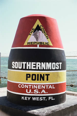
A picture of the famous buoy! I hope we can see it in person.
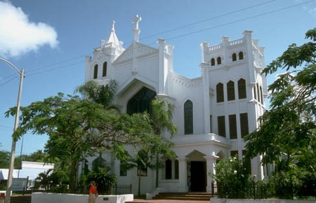
Another picture we found of Key West.
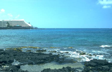
A picture we found of the beautiful beach at Key West.
The climate here is tropical. In fact, Key West claims to have never even had a frost (unlike every other city in the United States). This is probably because of the city's close location to the Straits of Florida, the Gulf of Mexico, and the Gulf Stream. The climate of Key West is similar to the climate of the Caribbean islands. I wonder how close Key West is to the equator? I know we are pretty far south. Does that put us closer to the equator? The coldest temperature ever recorded in Key West was back in 1886 at 41 degrees F. (How many years ago was that?) Why is the climate so much warmer as we go closer to the equator?
As you could see in the map, the Florida Keys are surrounded by water. It is bordered mainly by the Atlantic Ocean and the Gulf of Mexico. However, there are several smaller bodies of water surrounding the island as well.
Because of the tropical climate, Key West has notable wet and dry seasons. From November until April, Key West is full of sunshine with little rain (only a quarter of the yearly total). Considering that is during half the year, that isn't much rain. So far, we have experienced nothing but sunshine! May through October is the wet season; they get many showers, thunderstorms, and possibly hurricanes. The last hurricane to hit Key West (and the worst one in memory) was Hurricane Irma in 2017 resulting in 17 deaths just in the Keys. Interesting fact: Key West is the driest city in Florida. I wonder why that might be. Also, when the city does receive rain, it is usually in the early morning, unlike most other tropical climates, where the rainfall is typically in the afternoon hours.
We found out the exact address of Louie's house and are heading there first thing tomorrow morning. Best part is that Louie's house is only accessible by Hovercraft! That is one of those vehicles that will travel on a cushion of air over water or on land. I can't wait to take a ride. I have never even seen one, except in the movies.
Since it isn't dark yet, we are heading out to see the city! We are looking forward to seeing the famous jugglers, mimes, musicians, cafes, and more. We will be sure to take some pictures. Don't forget to check out the video clip we included in this blog entry. You will want to skip past the part about nightlife, since the night life stuff is not for us kids, but the rest of this video about Key West is really cool! Geo likes the part about the pirates!
- Geo
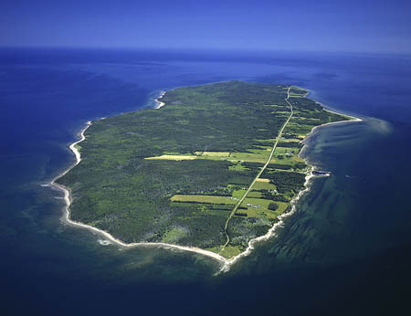
A picture we took while landing in Key West. This is a great shot of the island.
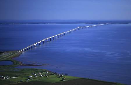
Another shot from the air. Look at the size of that bridge!
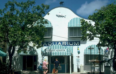
The aquarium we visited today.
Map of Florida Keys
What other countries are located close to the Florida Keys? Be sure to expand the map window so that you can see the entire map.
Video Clip
Check out this informative video about Key West! Really cool
You should see some of the architecture in this area. The buildings are amazing (as you probably saw in the video clip in our last blog entry). Well, I better get going. We have lots to do to prepare for our trip to Louie's house tomorrow morning.
- Meri
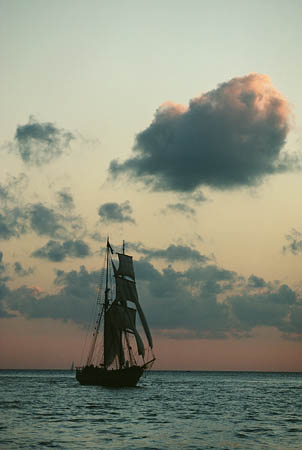
Key West at sunset.
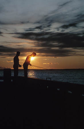
Another beautiful picture of the sunset (and some people fishing).
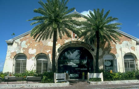
An interesting building we saw (it was a shopping center).
- Geo
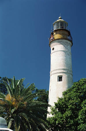
A lighthouse we saw on the way to Louie's house.
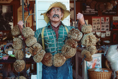
A carving from the market yesterday (Doesn't it look like a real person?)
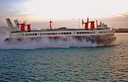
Here is a picture of a hovercraft. Photo by Andrew Berridge, licensed under Creative Commons. See full photo credit
Video clip
Check out this video clip from the old musical, \"Meet Me In St. Louis.\"
Map of United States
Take a look at this map. Can you help us find St. Louis? Is it in Kansas, Missouri, or Pennsylvania?
channel - bed of a stream or river, typically the deepest part of the river or harbor. Usually a broad strait that connects two seas or other bodies of water.
climate - the weather in a particular area: including temperature, precipitation, and wind.
elevation - the altitude (or how high) a location is above sea level.
equator - an imaginary line on the earth's surface that is positioned halfway between the north pole and the south pole. The equator divides the earth into the northern hemisphere and the southern hemisphere.
gulf - a small portion of the sea or ocean that is partly enclosed by land. Gulfs are larger than bays.
Gulf Stream - a warm ocean current originating in the Gulf of Mexico. It passes through the Straits of Florida and flows northward along the southeast coast of the United States.
hurricane - a severe tropical storm with heavy rains and high winds.
hurricanes - severe tropical storms with heavy rains and high winds.
island - land that is surrounded on all sides by water.
seceded - withdrew from a political entity (such as a country), union, or organization.
Straits - narrow passageways that connect two larger bodies of water.
Straits of Florida - straits located in southeast United States, located between the Gulf of Mexico and the Atlantic Ocean, and between the Florida Keys and Cuba.
tropical - a climate with high temperatures and a decent amount of rainfall. Tropical climates are usually located between the Tropic of Cancer and the Tropic of Capricorn, closer to the equator than cooler, temperate climates.
tropical climate - a climate typically having high temperatures and a decent amount of rainfall. Tropical climates are usually located between the Tropic of Cancer and the Tropic of Capricorn, closer to the equator than cooler, temperate climates.
Back to top
Grade 3-5: Knows the basic elements of maps and globes (title, legend, cardinal, scale, grid, meridians, time zones, etc.).
Grade 6-8: Understands concepts such as axis, seasons, rotation, and revolution.
Grade 3-5: Knows major physical and human features of places as they are represented on maps and globes. Knows how to read different maps: road, relief, globe, etc..
Grade 3-5: Knows the location of major cities in North America.
Grade 3-5: Knows the approximate location of major continents, mountain ranges, and bodies of water on Earth.
Grade 6-8: Knows the location of physical and human features on maps and globes (e.g., culture hearths such as Mesopotamia, Huang Ho, the Yucatan Peninsula, the Nile Valley; major ocean currents; wind patterns; land forms; climate regions).
Grade 6-8: Knows the relative location of, size of, and distances between places.
Grade 3-5: Knows different methods to measure data (miles, kilometers, time, etc..).
Grade 6-8: Knows the human characteristics of places (e.g., cultural characteristics such as religion, language, politics, technology, family structure, gender; population characteristics; land uses; levels of development).
Grade 3-5: Knows the characteristics of a variety of regions (climate, housing, religion, language, etc..).
Grade 6-8: Understands criteria that give a region identity (such as Amsterdam as a transportation center or the Sunbelt's warm climate and popularity with retired people).
Grade 3-5: Knows the physical components of Earth's atmosphere (weather and climate), lithosphere (land forms such as mountains), hydrosphere (oceans, lakes and rivers), and biosphere (vegetation and biomes).
Grade 3-5: Knows how Earth's position relative to the Sun affects events and conditions on Earth.
Grade 3-5: Knows how and why people divide Earth's surface into political and/or economic units (e.g., states in the United States and Mexico; provinces in Canada; countries in North and South America; countries linked in cooperative relationships, such as the European Union).
Grade 3-5: Knows how communities benefit from the physical environment (e.g., people make their living by farming on fertile land, fishing in local water, working in mines; the community is a port located on a natural harbor, a tourist center located in a scenic or historic area, an industrial center with good access to natural resources).
Grade 3-5: Knows natural hazards that occur in the physical environment (floods, tornadoes, earthquakes, etc..).