
Teacher Edition | View the Map
Week of March 10, 2024
Right click and SAVE AS
to download the Google Earth file for this episode
Use free Google Earth software
to OPEN it, using File> Open.
Find more tech info here.
- Meri
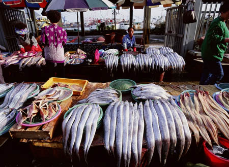
A picture of a fish market that we found online!
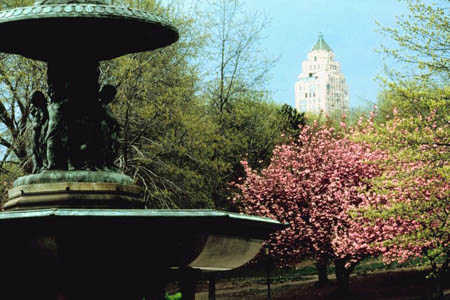
Another picture we found, Central Park in New York City. Do you see the big building in the background? New York City has LOTS of big buildings!
There are many famous landmarks in the city: the Empire State Building and the Statue of Liberty are both famous throughout the world. See the photos with this post.
Did you know that over 800 languages are spoken in New York City! Wow! I wonder if all of those people can understand English. 40% of the population of New York City was born outside of the United States (that's getting close to half the population). The city has many cool nicknames: Big Apple, The City That Never Sleeps, Gotham, The Capital of the World, and more. I can't wait to get there! We found a neat site all about the city. Be sure to check it out. We will write more when we arrive.
- Geo
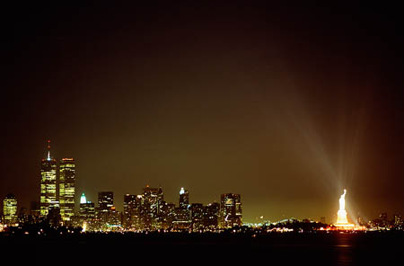
Look at this amazing picture we found of the Statue of Liberty illuminated at night! Wow!
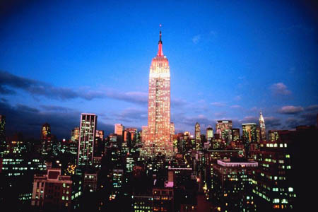
Sunset on the Empire State Building
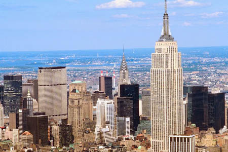
Another shot of the Empire State Building (and many other HUGE buildings).
Fun Facts about New York City
Learn about New York City!
It isn't nearly as cold here as I expected. New York has a humid subtropical climate and has about 234 days of sunshine every year. New York experiences all four seasons. Summers are hot and humid; winters are cold and windy (but warmer than inland cities such as Chicago and Pittsburgh). Spring and fall are both unpredictable but typically have moderate temperatures.
One really cool thing about visiting New York City is getting to ride (and hail) a cab. We took a cab to the Empire State Building and Central Park. We also rode the ferry that goes to Ellis Island and to the Statue of Liberty. It has been a busy day. I. Love. New York! Holy Idaho!! We took more pictures, and don't forget to check out the map.
- Meri
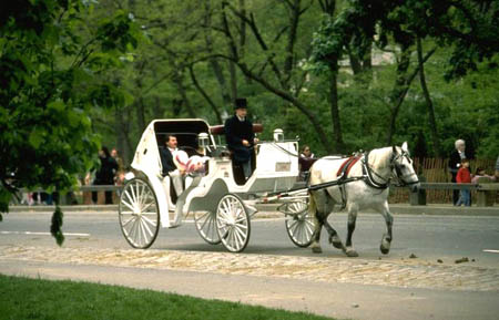
A couple taking a carriage ride through Central Park. Wish we would have had time to do that!
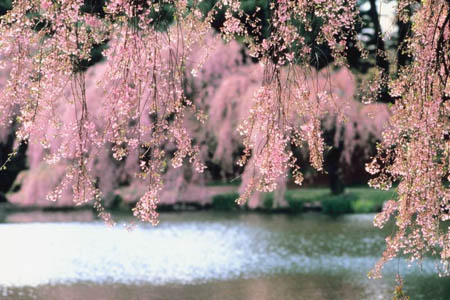
Central Park - favorite stop of the day.
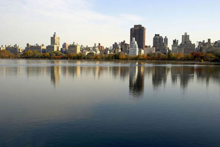
Another beautiful shot from Central Park.
United States Map
Take a look at this map of the United States. Can you find St. Louis and New York City? What cardinal direction did we travel? What else do you notice on this map? Do you know what type of map this is? What landforms can you see? Do you see any other places we have visited on this mission?
Text from Pandora: GT trying 2 call U 2. Can't get thru.
Text to Pandora: Thx
We realized that our cell battery had died! Talk about bad timing! We had been out investigating in the city all day, so we didn't even realize our phone's battery had died until we plugged it in at the hotel and found the text from Pandora. Good news though! We have a lead. Louie made a purchase in the city of Seattle. Uncle GT was smart and called the hotel where the purchase was made to confirm that Louie was really staying at that hotel. They wouldn't confirm that he was there, but they did help out in two ways. First, they told Uncle GT that Louie was seen walking through the lobby a few minutes before with two gentlemen. The hotel personnel were not sure WHO the other two gentlemen were. Second, the hotel personnel told Uncle GT that they couldn't tell him Louie's hotel room number, but they could connect him to Louie's room. BINGO - now we know the city and even the exact hotel name and location where Louie is staying! Now the fish market makes sense. Seattle has a TON of fish markets and one very famous one downtown. Uncle GT is a bit worried about our safety since Louie is acting strange and has two unknown gentlemen escorting him through the hotel lobby. So, Uncle GT is flying up here to meet us and travel with us to Seattle. We will update once we arrive and are "Sleepless in Seattle." In what part of the United States is Seattle located?
- Geo
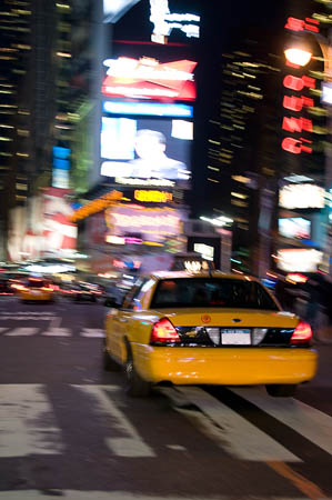
The cab we rode in today (this is the cab driving away from our hotel).
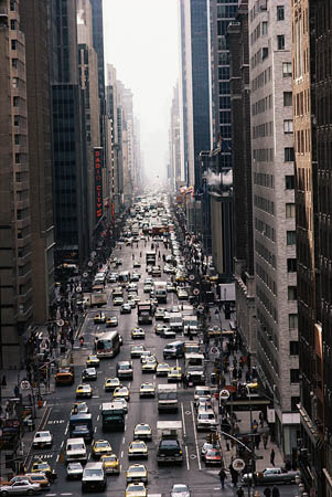
The view of the city from our hotel window.
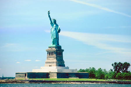
A picture we took of the Statue of Liberty.
Another map of the United States
Take a look at this map of the United States. Can you find Seattle? Do you know what state Seattle is located in? What part of the United States contains Seattle? Is Seattle in the northeastern U.S., northwestern U.S., or the Great Plains?
cardinal direction - a term used to describe all four primary directions (north, south, east and west).
estuary - the meeting place for fresh water (rivers) and salt water (oceans). Many cities located at estuaries have become important centers of commerce due to the convenience of the port.
humid subtropical climate - a climate with hot, humid summers and cool winters.
island - land that is surrounded on all sides by water.
moderate - a climate that doesn't have extremely cold winters or hot summers.
populous - an area heavily populated or containing a lot of people.
port - a place on a waterway with facilities for loading and unloading ships (cargo, passengers, etc.).
Back to top
Grade 3-5: Knows the basic elements of maps and globes (title, legend, cardinal, scale, grid, meridians, time zones, etc.).
Grade 6-8: Understands concepts such as axis, seasons, rotation, and revolution.
Grade 3-5: Knows major physical and human features of places as they are represented on maps and globes. Knows how to read different maps: road, relief, globe, etc..
Grade 3-5: Knows the location of major cities in North America.
Grade 6-8: Understands distributions of physical and human occurrences with respect to spatial patterns, arrangements, and associations (e.g. why some areas are more densely settled than others).
Grade 6-8: Knows the human characteristics of places (e.g., cultural characteristics such as religion, language, politics, technology, family structure, gender; population characteristics; land uses; levels of development).
Grade 3-5: Knows the characteristics of a variety of regions (climate, housing, religion, language, etc..).
Grade 6-8: Understands criteria that give a region identity (such as Amsterdam as a transportation center or the Sunbelt's warm climate and popularity with retired people).
Grade 6-8: Knows how places and regions serve as cultural symbols (Opera House in Sydney or Tower Bridge in London).
Grade 3-5: Knows the physical components of Earth's atmosphere (weather and climate), lithosphere (land forms such as mountains), hydrosphere (oceans, lakes and rivers), and biosphere (vegetation and biomes).
Grade 3-5: Knows how communities benefit from the physical environment (e.g., people make their living by farming on fertile land, fishing in local water, working in mines; the community is a port located on a natural harbor, a tourist center located in a scenic or historic area, an industrial center with good access to natural resources).